Visualizing spatial data II
Lecture 18
Dr. Benjamin Soltoff
Cornell University
INFO 3312/5312 - Spring 2026
March 26, 2026
Announcements
Announcements
- Posit Workbench - issues rendering mini-projects
- Sign-up for mini-project oral exams
- Homework 05
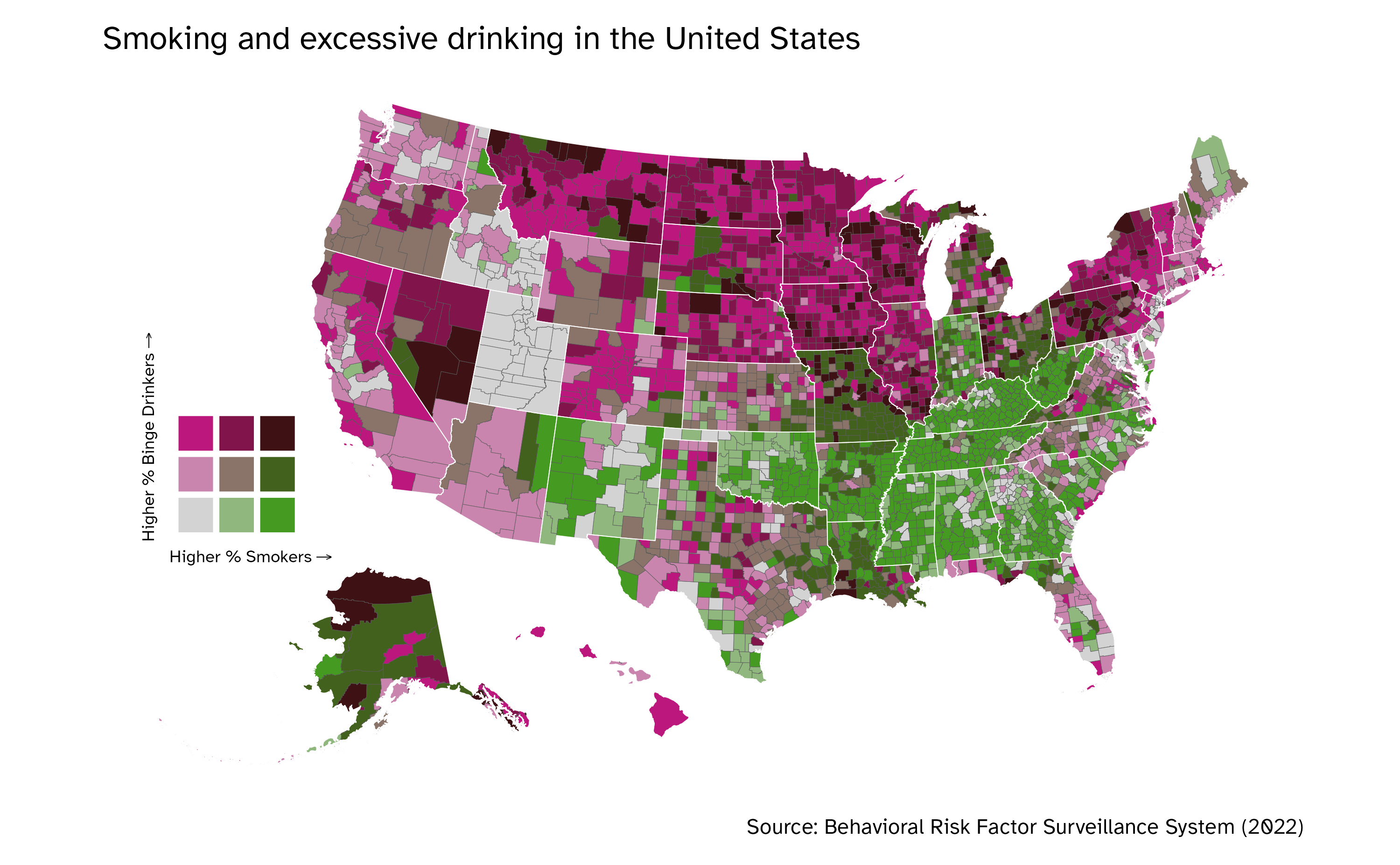
- What does the map tell you?
- How effective is the bivariate color palette?
Original implementation. Inspired by @townusa.bsky.social
Learning objectives
- Define vector files for storing geospatial data
- Import spatial data using the {sf} package
- Generate maps using {ggplot2} and
geom_sf() - Transform coordinate systems
Structuring map data in R
Map data file formats
- Vector files
- Raster images
- Numeric data
- Popular formats
- Shapefile
- GeoJSON
Shapefile
- Encodes points, lines, and polygons
- Collection of files
.shp- geographic coordinates.dbf- data associated with the geographic features.prj- projection of the coordinates in the shapefile
-- geo_export_6fd95df5-1136-4829-8f2d-9cb5d1cc2222.dbf
-- geo_export_6fd95df5-1136-4829-8f2d-9cb5d1cc2222.prj
-- geo_export_6fd95df5-1136-4829-8f2d-9cb5d1cc2222.shp
-- geo_export_6fd95df5-1136-4829-8f2d-9cb5d1cc2222.shx
GeoJSON
Uses JavaScript Object Notation (JSON) file format
Plain text files
Simple Features for R
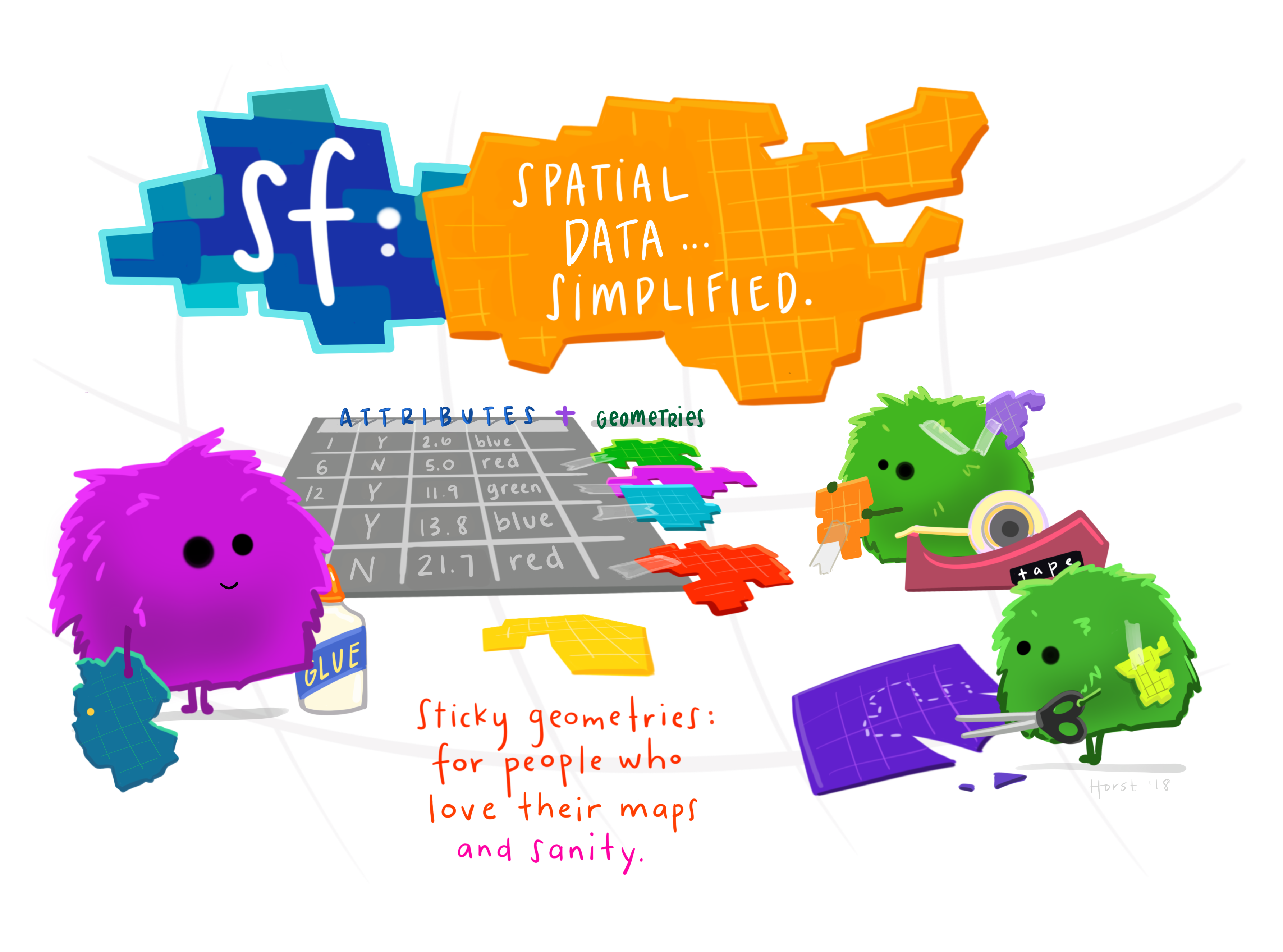
Image credit: Allison Horst
What is a feature?
- Thing or an object in the real world
- Sets of features
- Geometry
- Attributes
Simple features
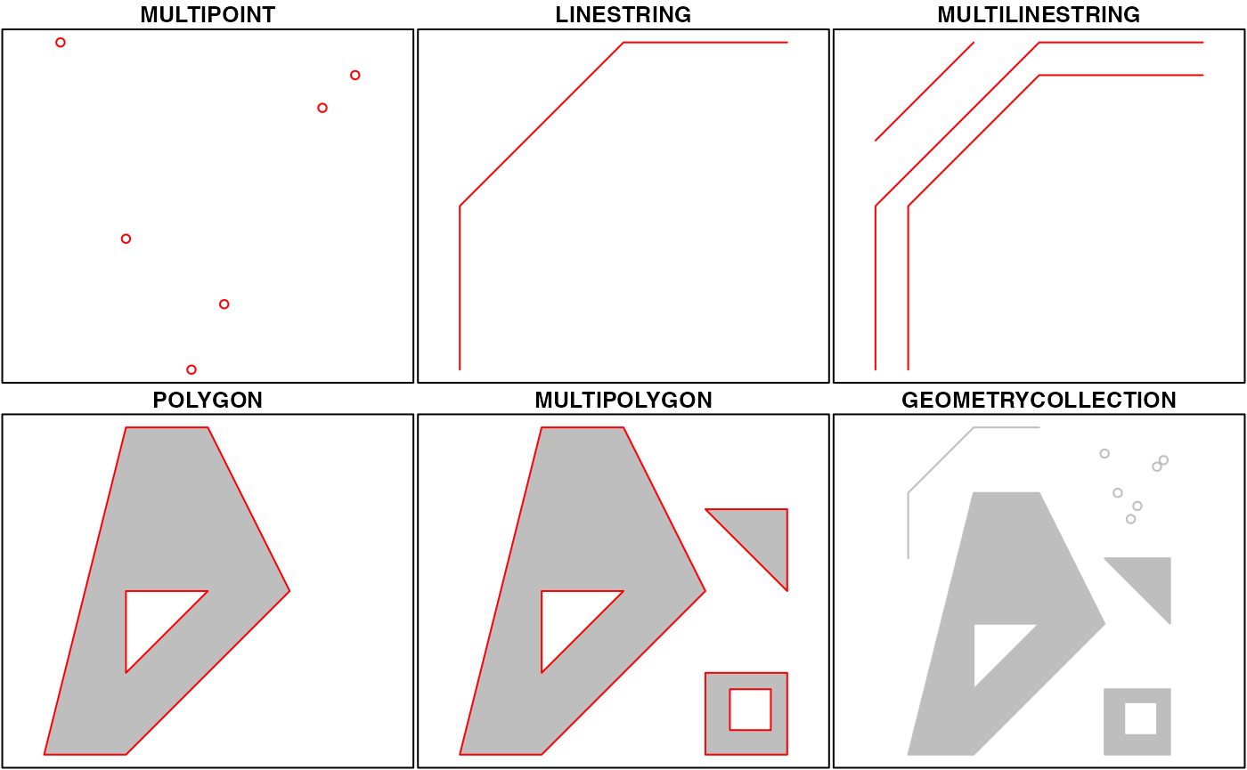
Source: Simple Features for R
Simple features in R
- Uses basic R data structures
- Data frame with one row per feature
- Lots of list columns
Importing shapefiles
Simple feature collection with 5 features and 4 fields
Geometry type: MULTIPOLYGON
Dimension:     XY
Bounding box:  xmin: -74.25559 ymin: 40.49613 xmax: -73.70001 ymax: 40.91553
Geodetic CRS:  WGS84(DD)
  boro_code     boro_name shape_area shape_leng                       geometry
1         5 Staten Island 1623631283   325924.0 MULTIPOLYGON (((-74.05051 4...
2         2         Bronx 1187189499   463277.2 MULTIPOLYGON (((-73.89681 4...
3         1     Manhattan  636605816   359103.2 MULTIPOLYGON (((-74.01093 4...
4         3      Brooklyn 1934169229   728478.1 MULTIPOLYGON (((-73.86327 4...
5         4        Queens 3041397430   888238.6 MULTIPOLYGON (((-73.82645 4...
Importing GeoJSON files
Simple feature collection with 5 features and 4 fields
Geometry type: MULTIPOLYGON
Dimension:     XY
Bounding box:  xmin: -74.25559 ymin: 40.49613 xmax: -73.70001 ymax: 40.91553
Geodetic CRS:  WGS 84
  boro_code     boro_name    shape_area    shape_leng                       geometry
1         5 Staten Island 1623631283.36 325924.002076 MULTIPOLYGON (((-74.05051 4...
2         2         Bronx  1187189499.3 463277.240478 MULTIPOLYGON (((-73.89681 4...
3         1     Manhattan 636605816.437 359103.151368 MULTIPOLYGON (((-74.01093 4...
4         3      Brooklyn 1934169228.83 728478.125489 MULTIPOLYGON (((-73.86327 4...
5         4        Queens 3041397430.33 888238.562635 MULTIPOLYGON (((-73.82645 4...
Visualizing {sf} objects
Drawing maps with {sf} objects
Simple feature collection with 56 features and 9 fields
Geometry type: MULTIPOLYGON
Dimension: XY
Bounding box: xmin: -179.1467 ymin: -14.5487 xmax: 179.7785 ymax: 71.38782
Geodetic CRS: NAD83
First 10 features:
STATEFP STATENS GEOIDFQ GEOID STUSPS NAME LSAD ALAND AWATER
1 35 00897535 0400000US35 35 NM New Mexico 00 314198519809 726531289
2 46 01785534 0400000US46 46 SD South Dakota 00 196341670967 3387563375
3 06 01779778 0400000US06 06 CA California 00 403673433805 20291632828
4 21 01779786 0400000US21 21 KY Kentucky 00 102266755818 2384136185
5 01 01779775 0400000US01 01 AL Alabama 00 131185561946 4581813708
6 13 01705317 0400000US13 13 GA Georgia 00 149485762701 4419221858
7 05 00068085 0400000US05 05 AR Arkansas 00 134658517854 3122715710
8 42 01779798 0400000US42 42 PA Pennsylvania 00 115881476238 3397613881
9 29 01779791 0400000US29 29 MO Missouri 00 178052403953 2487375487
10 08 01779779 0400000US08 08 CO Colorado 00 268418973518 1185541418
geometry
1 MULTIPOLYGON (((-109.0502 3...
2 MULTIPOLYGON (((-104.0579 4...
3 MULTIPOLYGON (((-118.6044 3...
4 MULTIPOLYGON (((-89.40565 3...
5 MULTIPOLYGON (((-88.05338 3...
6 MULTIPOLYGON (((-81.27939 3...
7 MULTIPOLYGON (((-94.61792 3...
8 MULTIPOLYGON (((-80.51989 4...
9 MULTIPOLYGON (((-95.77355 4...
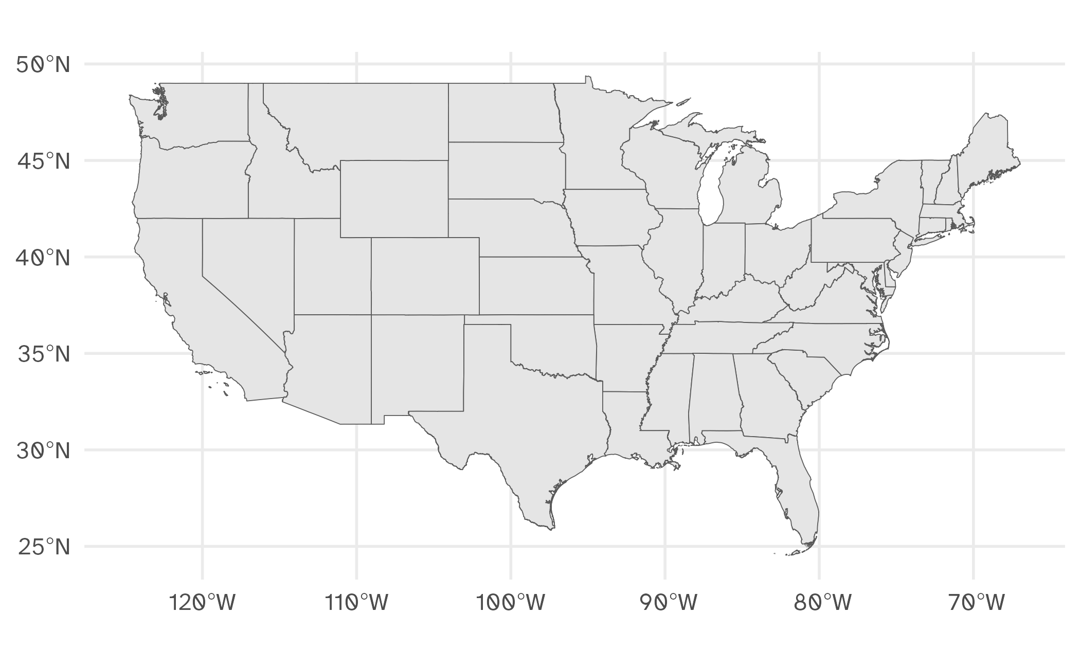
10 MULTIPOLYGON (((-109.0603 3...USA boundaries
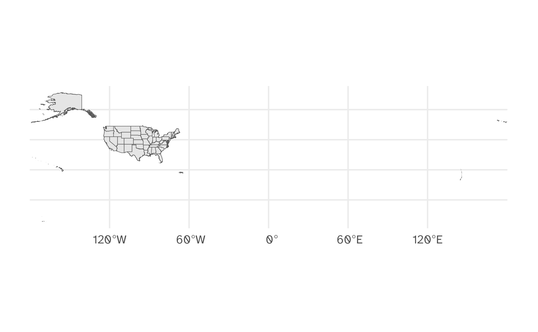
Plot a subset of a map
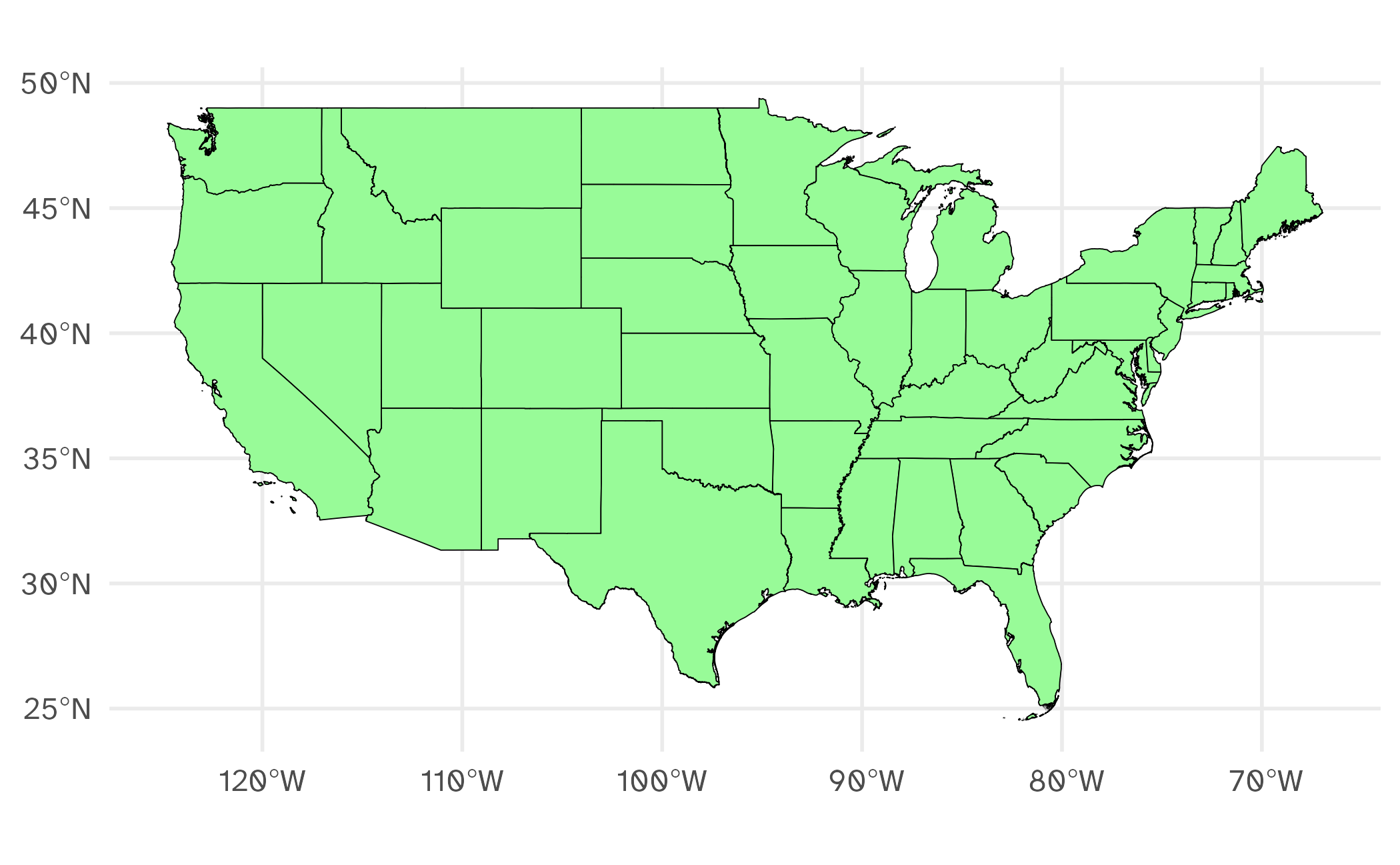
Just another ggplot()
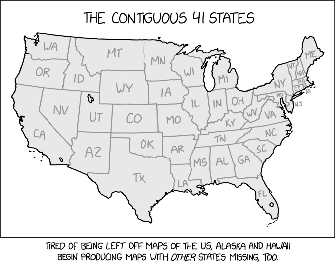
Source: xkcd
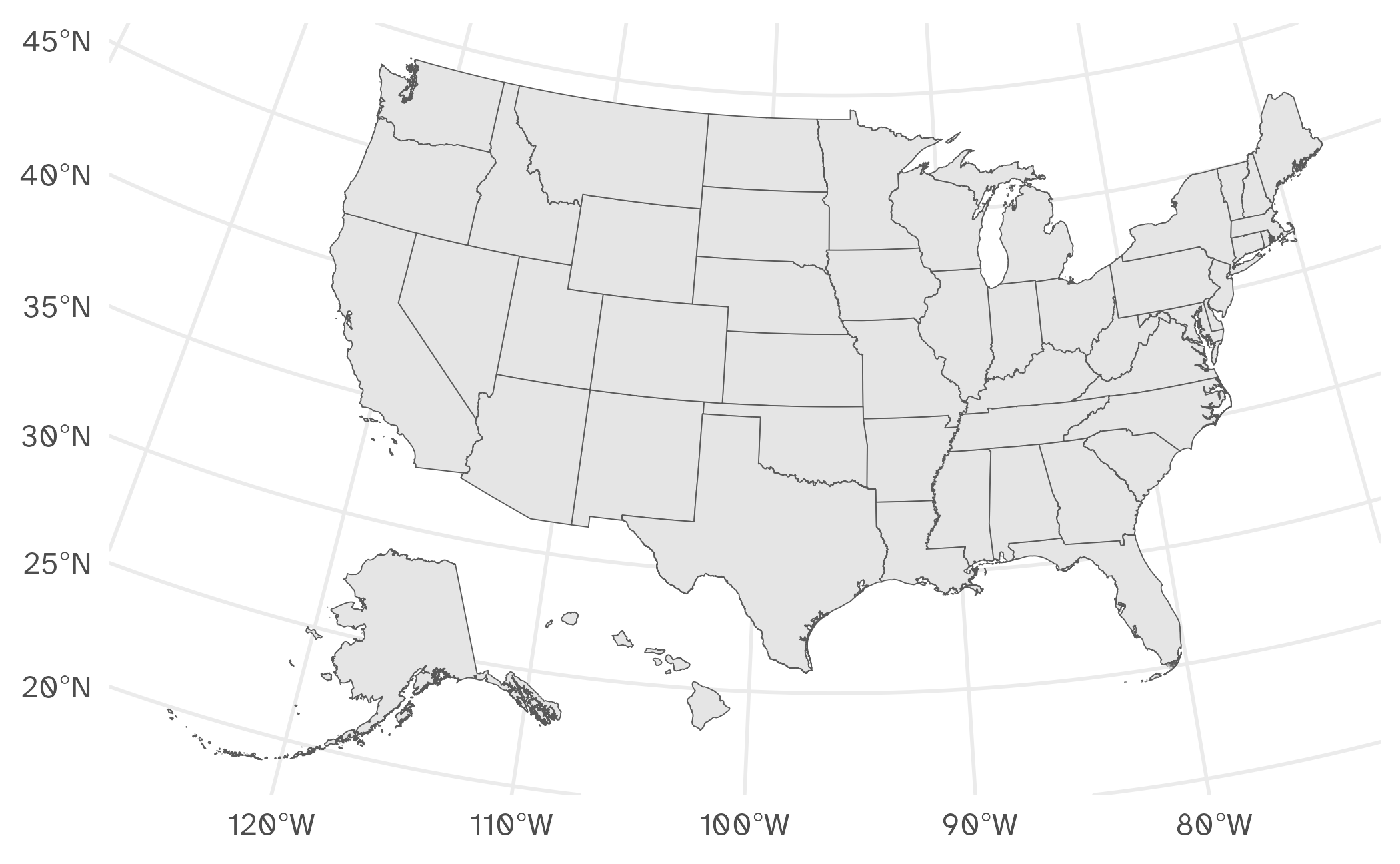
shift_geometry()
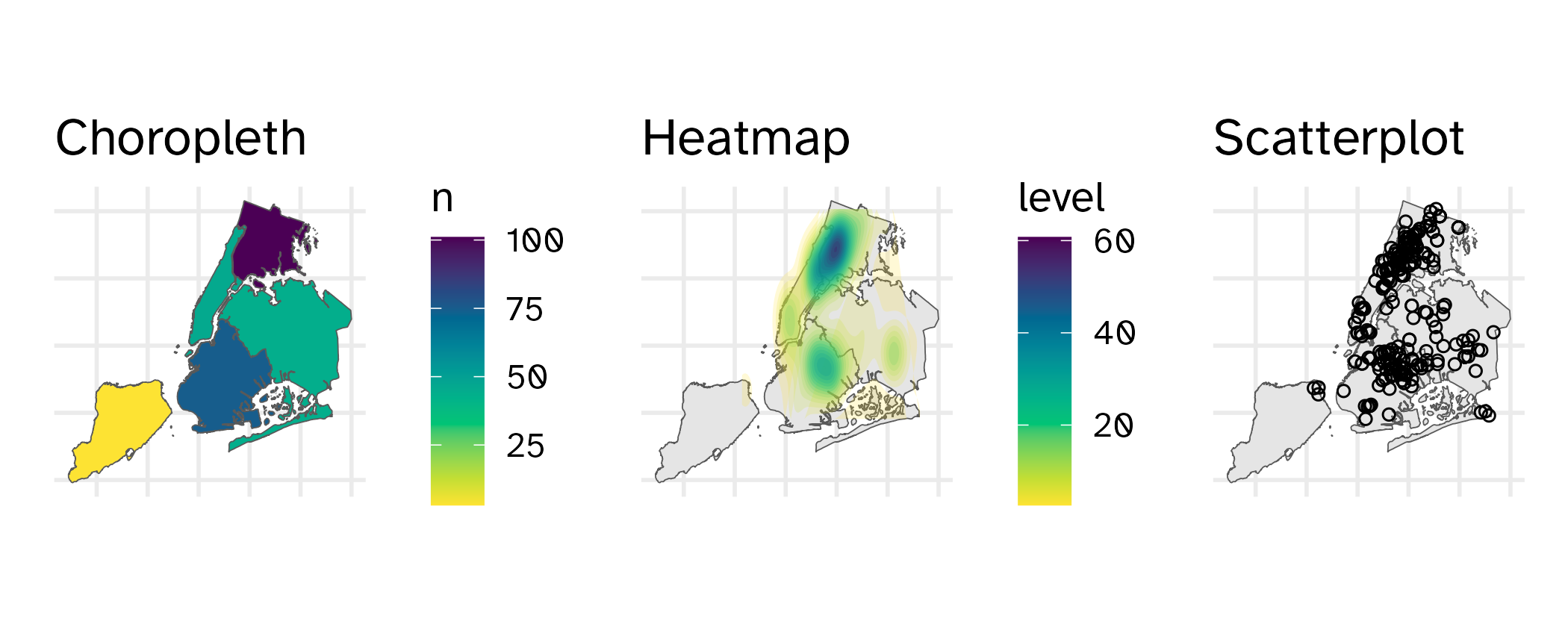
Identifying points on a map
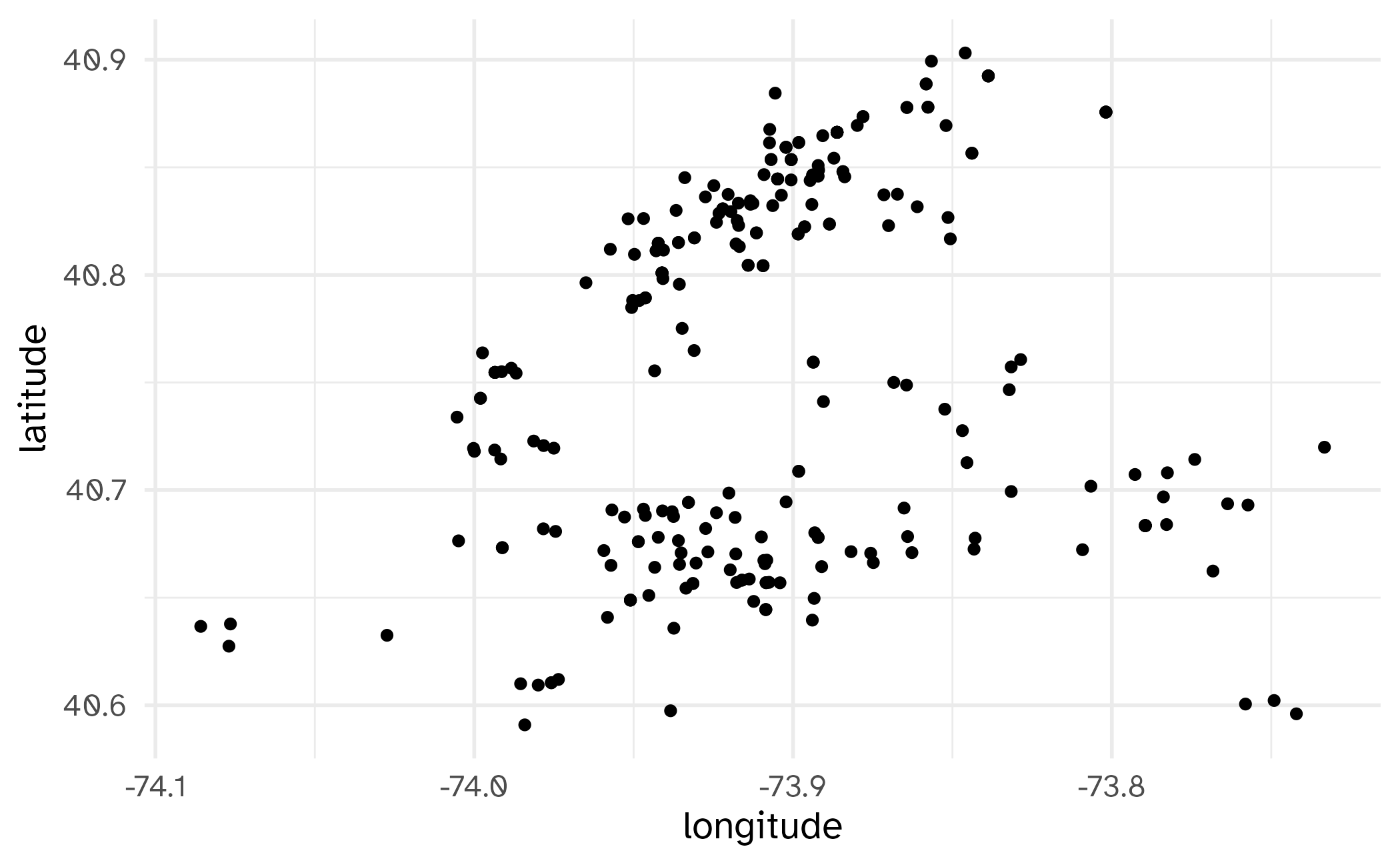
Points
# A tibble: 269 × 7
   cmplnt_num    boro_nm   cmplnt_fr_dt        law_cat_cd ofns_desc               latitude longitude
   <chr>         <chr>     <dttm>              <chr>      <chr>                      <dbl>     <dbl>
 1 240954923H1   BROOKLYN  1977-12-20 05:00:00 FELONY     MURDER & NON-NEGL. MAN…     40.7     -74.0
 2 245958045H1   BROOKLYN  2001-08-13 04:00:00 FELONY     MURDER & NON-NEGL. MAN…     40.7     -73.9
 3 8101169H6113  MANHATTAN 2005-03-06 05:00:00 FELONY     MURDER & NON-NEGL. MAN…     40.8     -73.9
 4 8101169H6113  MANHATTAN 2005-03-06 05:00:00 FELONY     MURDER & NON-NEGL. MAN…     40.8     -73.9
 5 16631466H8909 BROOKLYN  2006-05-24 04:00:00 FELONY     MURDER & NON-NEGL. MAN…     40.7     -73.9
 6 246056367H1   QUEENS    2015-05-13 04:00:00 FELONY     MURDER & NON-NEGL. MAN…     40.6     -73.7
 7 243507594H1   MANHATTAN 2020-06-19 04:00:00 FELONY     MURDER & NON-NEGL. MAN…     40.8     -74.0
 8 243688124H1   BROOKLYN  2021-01-31 05:00:00 FELONY     MURDER & NON-NEGL. MAN…     40.7     -73.9
 9 240767513H1   BROOKLYN  2021-02-17 05:00:00 FELONY     MURDER & NON-NEGL. MAN…     40.6     -74.0
10 240767512H1   BROOKLYN  2021-05-24 04:00:00 FELONY     MURDER & NON-NEGL. MAN…     40.6     -74.0
# ℹ 259 more rows
Points
Points
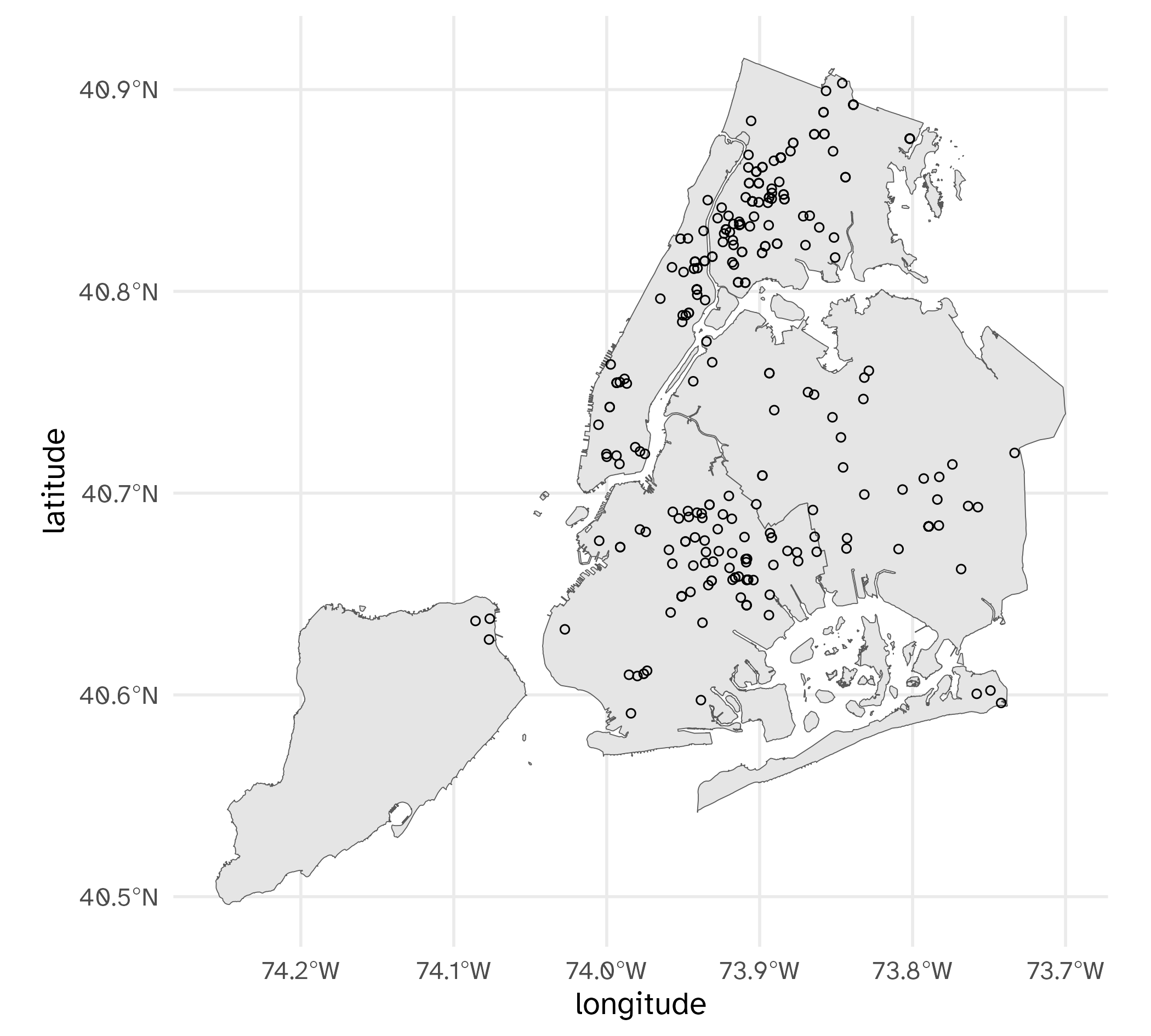
Converting to {sf} data frame
Simple feature collection with 269 features and 5 fields
Geometry type: POINT
Dimension:     XY
Bounding box:  xmin: -74.08578 ymin: 40.59087 xmax: -73.73331 ymax: 40.90316
Geodetic CRS:  WGS 84
# A tibble: 269 × 6
   cmplnt_num    boro_nm   cmplnt_fr_dt        law_cat_cd ofns_desc                    geometry
 * <chr>         <chr>     <dttm>              <chr>      <chr>                     <POINT [°]>
 1 240954923H1   BROOKLYN  1977-12-20 05:00:00 FELONY     MURDER & NON-NE… (-73.97448 40.68079)
 2 245958045H1   BROOKLYN  2001-08-13 04:00:00 FELONY     MURDER & NON-NE… (-73.92013 40.69862)
 3 8101169H6113  MANHATTAN 2005-03-06 05:00:00 FELONY     MURDER & NON-NE… (-73.94295 40.81126)
 4 8101169H6113  MANHATTAN 2005-03-06 05:00:00 FELONY     MURDER & NON-NE… (-73.94295 40.81126)
 5 16631466H8909 BROOKLYN  2006-05-24 04:00:00 FELONY     MURDER & NON-NE…  (-73.91796 40.6703)
 6 246056367H1   QUEENS    2015-05-13 04:00:00 FELONY     MURDER & NON-NE…  (-73.7491 40.60219)
 7 243507594H1   MANHATTAN 2020-06-19 04:00:00 FELONY     MURDER & NON-NE… (-73.95732 40.81194)
 8 243688124H1   BROOKLYN  2021-01-31 05:00:00 FELONY     MURDER & NON-NE…  (-73.8627 40.67093)
 9 240767513H1   BROOKLYN  2021-02-17 05:00:00 FELONY     MURDER & NON-NE… (-73.97582 40.61046)
10 240767512H1   BROOKLYN  2021-05-24 04:00:00 FELONY     MURDER & NON-NE… (-73.97582 40.61046)
# ℹ 259 more rows
Plotting with two sf data frames
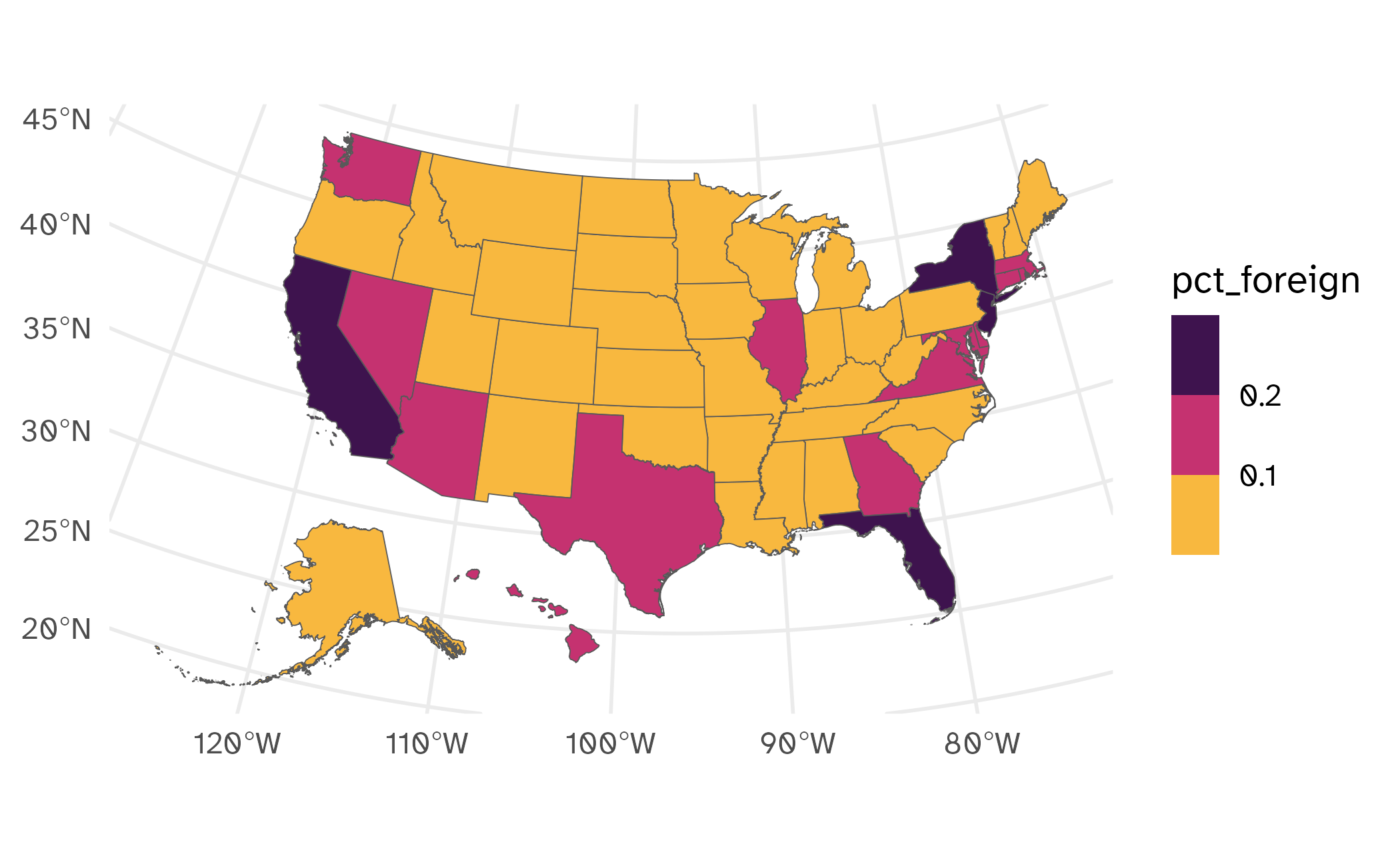
Choropleths

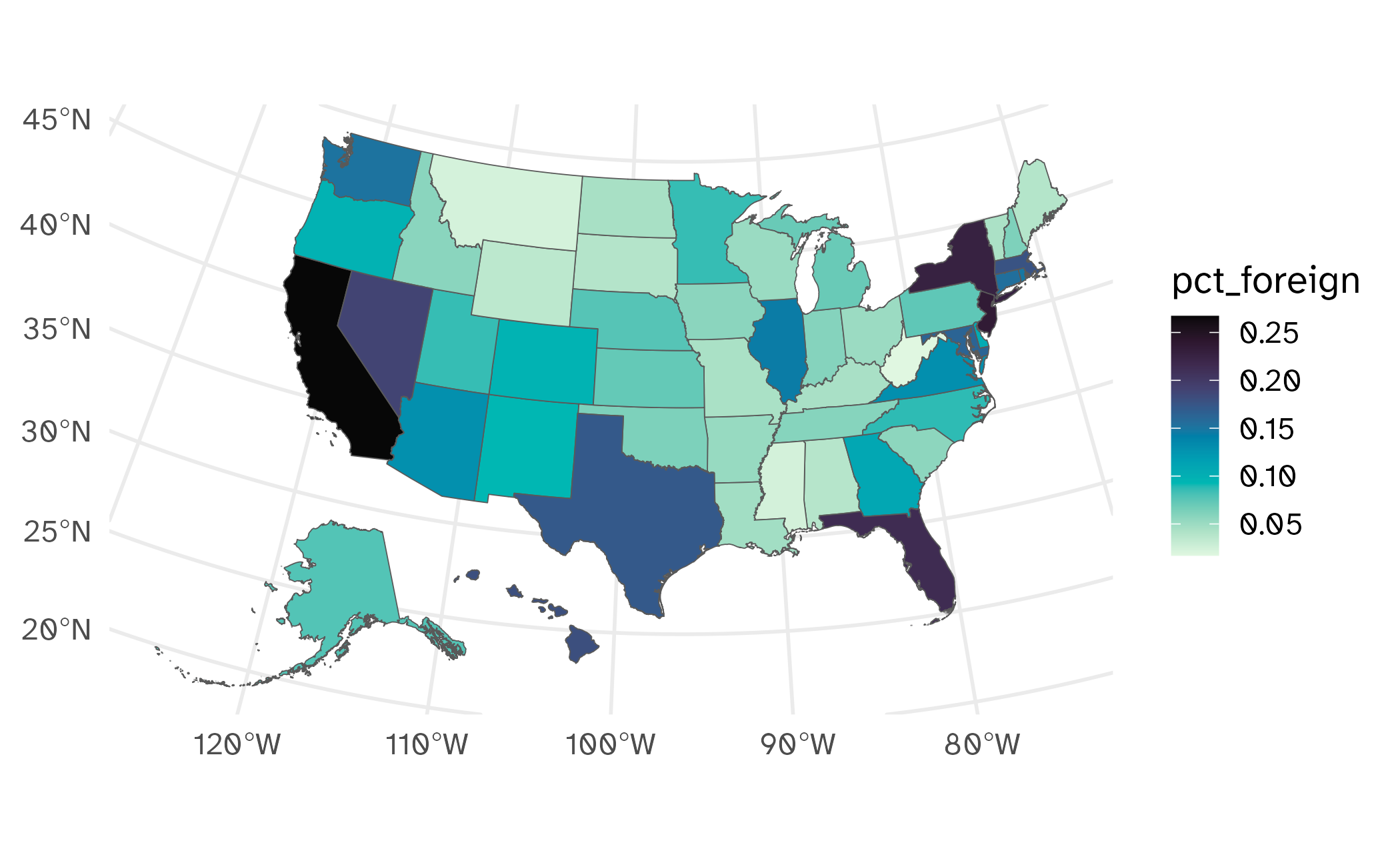
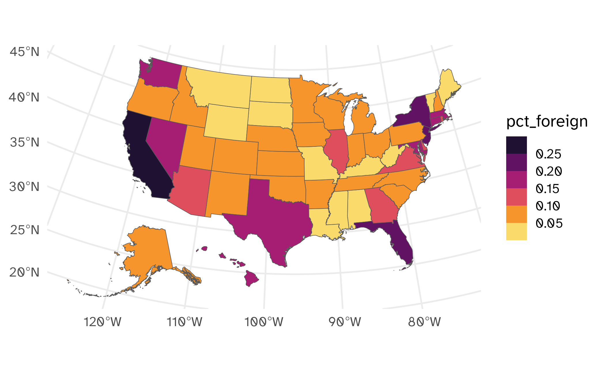
Fill (choropleths)
usa_fb <- get_acs(
  geography = "state",
  variables = c(total = "B05002_001E", native = "B05002_002E",
                foreign = "B05002_013E"),
  year = 2024,
  output = "wide",
  geometry = TRUE
) |>
  select(GEOID, NAME, total, native, foreign) |>
  mutate(pct_foreign = foreign / total) |>
  filter(NAME %in% state.name) |>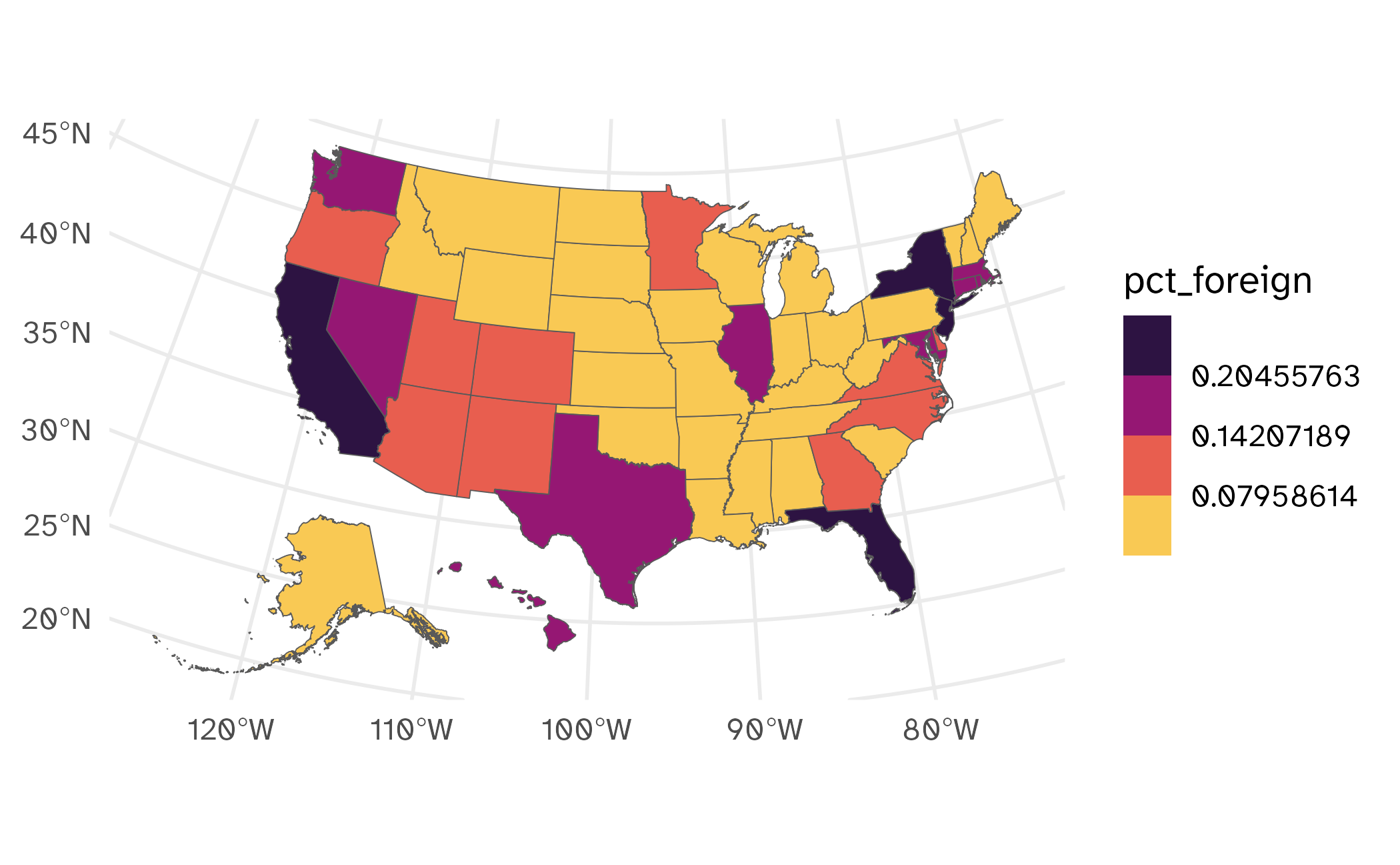
shift_geometry()Simple feature collection with 50 features and 6 fields
Geometry type: MULTIPOLYGON
Dimension: XY
Bounding box: xmin: -3111747 ymin: -1697746 xmax: 2258200 ymax: 1565782
Projected CRS: USA_Contiguous_Albers_Equal_Area_Conic
First 10 features:
GEOID NAME total native foreign pct_foreign geometry
1 35 New Mexico 2120246 1920508 199738 0.09420511 MULTIPOLYGON (((-1231344 -5...
2 46 South Dakota 907428 871440 35988 0.03965934 MULTIPOLYGON (((-633765.6 8...
3 06 California 39287377 28689076 10598301 0.26976352 MULTIPOLYGON (((-2066923 -2...
4 21 Kentucky 4534824 4323614 211210 0.04657513 MULTIPOLYGON (((584560 -886...
5 01 Alabama 5086768 4883190 203578 0.04002109 MULTIPOLYGON (((760323.7 -7...
6 13 Georgia 10940407 9717629 1222778 0.11176714 MULTIPOLYGON (((1390722 -58...
7 05 Arkansas 3049391 2883651 165740 0.05435184 MULTIPOLYGON (((122656.3 -1...
8 42 Pennsylvania 13018639 12013664 1004975 0.07719509 MULTIPOLYGON (((1287712 486...
9 29 Missouri 6191814 5913847 277967 0.04489266 MULTIPOLYGON (((19008.51 34...
10 08 Colorado 5862189 5285536 576653 0.09836820 MULTIPOLYGON (((-1123223 20...Draw the map
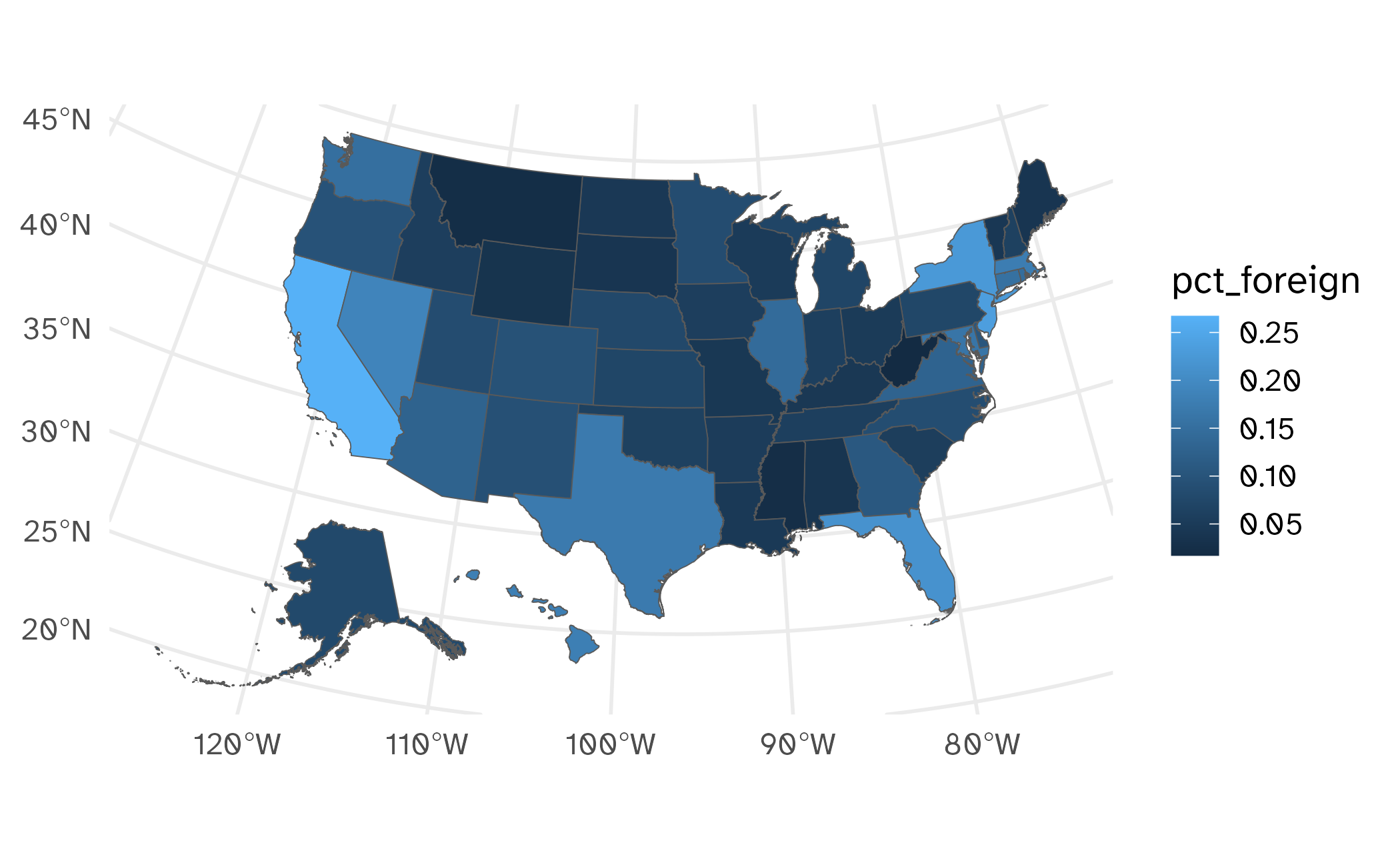
Use better colors
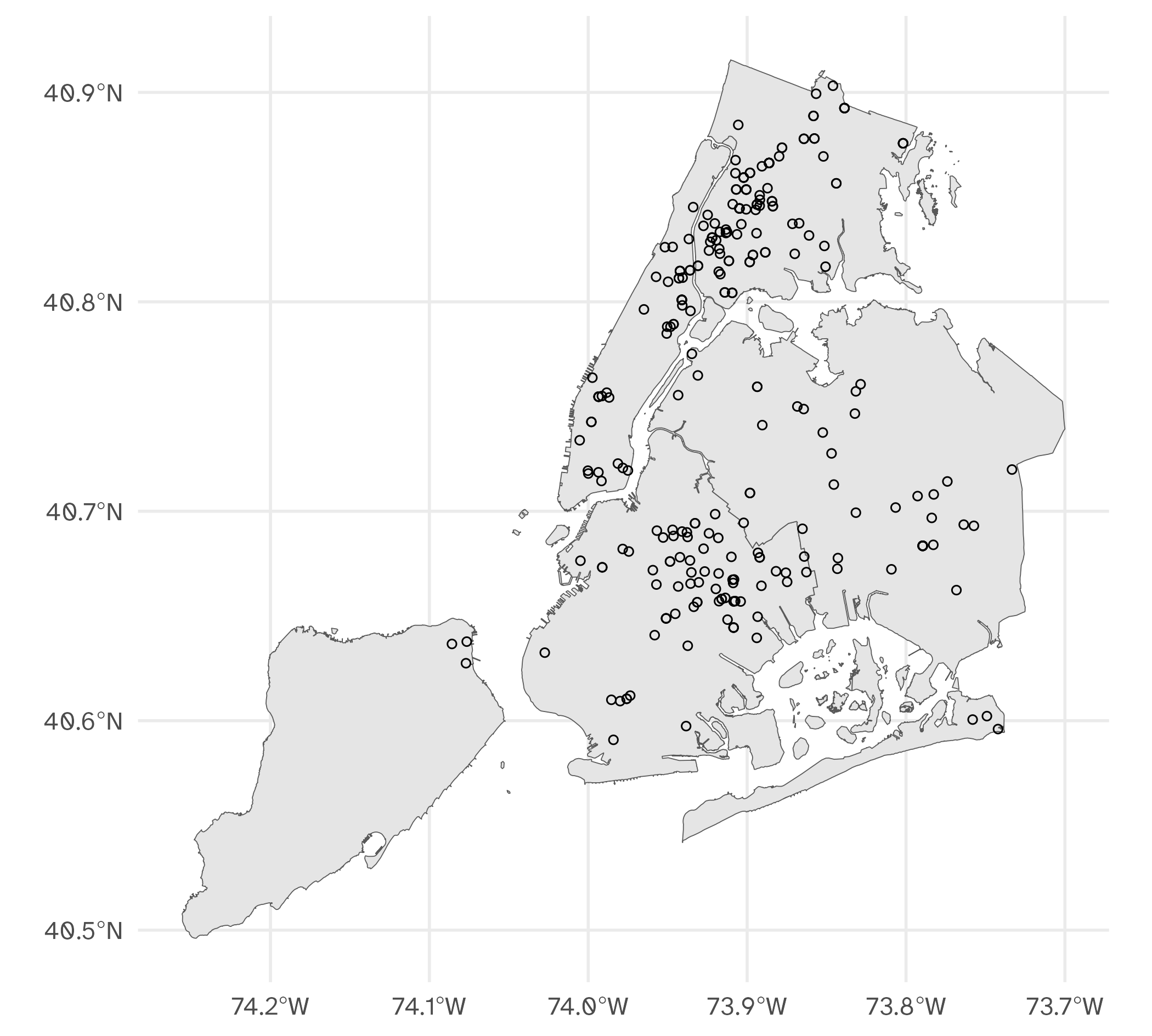
Spatial aggregation
Spatial aggregation
Simple feature collection with 269 features and 9 fields
Geometry type: MULTIPOLYGON
Dimension:     XY
Bounding box:  xmin: -74.25559 ymin: 40.49613 xmax: -73.70001 ymax: 40.91553
Geodetic CRS:  WGS 84
First 10 features:
    boro_code     boro_name    shape_area    shape_leng  cmplnt_num       boro_nm
1           5 Staten Island 1623631283.36 325924.002076 239347883H1 STATEN ISLAND
1.1         5 Staten Island 1623631283.36 325924.002076 244818447H1 STATEN ISLAND
1.2         5 Staten Island 1623631283.36 325924.002076 246985876H1 STATEN ISLAND
2           2         Bronx  1187189499.3 463277.240478 242029394H1         BRONX
2.1         2         Bronx  1187189499.3 463277.240478 242029394H1         BRONX
2.2         2         Bronx  1187189499.3 463277.240478 243573864H1         BRONX
2.3         2         Bronx  1187189499.3 463277.240478 244256173H1         BRONX
2.4         2         Bronx  1187189499.3 463277.240478 240776535H1         BRONX
2.5         2         Bronx  1187189499.3 463277.240478 240776535H1         BRONX
2.6         2         Bronx  1187189499.3 463277.240478 240776535H1         BRONX
           cmplnt_fr_dt law_cat_cd                       ofns_desc                       geometry
1   2022-01-18 05:00:00     FELONY MURDER & NON-NEGL. MANSLAUGHTER MULTIPOLYGON (((-74.05051 4...
1.1 2022-05-09 04:00:00     FELONY MURDER & NON-NEGL. MANSLAUGHTER MULTIPOLYGON (((-74.05051 4...
1.2 2022-06-21 04:00:00     FELONY MURDER & NON-NEGL. MANSLAUGHTER MULTIPOLYGON (((-74.05051 4...
2   2021-06-01 04:00:00     FELONY MURDER & NON-NEGL. MANSLAUGHTER MULTIPOLYGON (((-73.89681 4...
2.1 2021-06-01 04:00:00     FELONY MURDER & NON-NEGL. MANSLAUGHTER MULTIPOLYGON (((-73.89681 4...
2.2 2021-10-24 04:00:00     FELONY MURDER & NON-NEGL. MANSLAUGHTER MULTIPOLYGON (((-73.89681 4...
2.3 2021-12-17 05:00:00     FELONY MURDER & NON-NEGL. MANSLAUGHTER MULTIPOLYGON (((-73.89681 4...
2.4 2022-01-01 05:00:00     FELONY MURDER & NON-NEGL. MANSLAUGHTER MULTIPOLYGON (((-73.89681 4...
2.5 2022-01-01 05:00:00     FELONY MURDER & NON-NEGL. MANSLAUGHTER MULTIPOLYGON (((-73.89681 4...
2.6 2022-01-01 05:00:00     FELONY MURDER & NON-NEGL. MANSLAUGHTER MULTIPOLYGON (((-73.89681 4...
Spatial aggregation
Simple feature collection with 5 features and 2 fields
Geometry type: MULTIPOLYGON
Dimension:     XY
Bounding box:  xmin: -74.25559 ymin: 40.49613 xmax: -73.70001 ymax: 40.91553
Geodetic CRS:  WGS 84
      boro_name   n                       geometry
1         Bronx 101 MULTIPOLYGON (((-73.89679 4...
2      Brooklyn  75 MULTIPOLYGON (((-73.86318 4...
3     Manhattan  46 MULTIPOLYGON (((-74.0086 40...
4        Queens  44 MULTIPOLYGON (((-73.82646 4...
5 Staten Island   3 MULTIPOLYGON (((-74.05054 4...
Spatial aggregation
Which is better for comparisons?
Application exercise
ae-17
Instructions
- Go to the course GitHub org and find your
ae-17(repo name will be suffixed with your GitHub name). - Clone the repo in Positron, run
renv::restore()to install the required packages, open the Quarto document in the repo, and follow along and complete the exercises. - Render, commit, and push your edits by the AE deadline – end of the day
Bin continuous data to discrete intervals
Bin data to discrete intervals
- Continuous vs. discrete variables for color
- Collapse to a discrete variable
ggplot2::binned_scale()
ggplot2::binned_scale() with quartiles
ggplot2::binned_scale() with quartiles
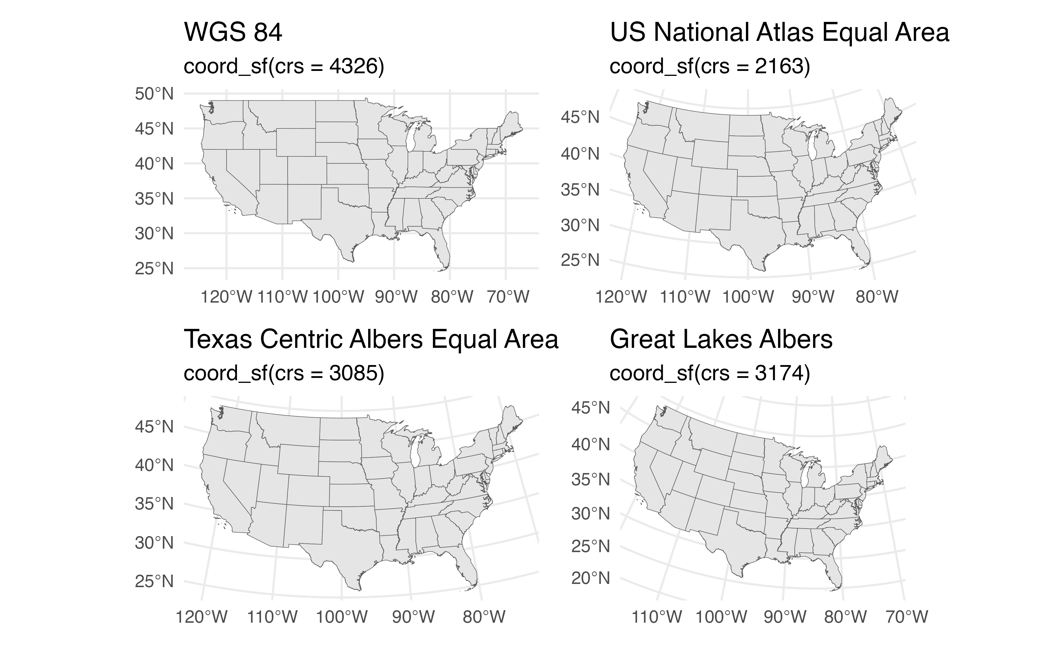
Map projection
Map projection
Map projection
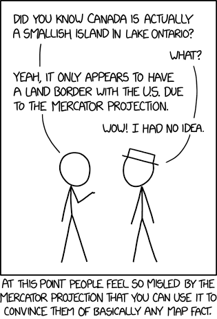
Image credit: xkcd
Map projection
- Coordinate reference system
- proj4string
- Well Known Text 2 (WKT2) string
US National Atlas Equal Area
proj4string
+proj=laea +lat_0=45 +lon_0=-100 +x_0=0 +y_0=0 +a=6370997 +b=6370997 +units=m +no_defsWKT2
PROJCS["US National Atlas Equal Area",
    GEOGCS["Unspecified datum based upon the Clarke 1866 Authalic Sphere",
        DATUM["Not_specified_based_on_Clarke_1866_Authalic_Sphere",
            SPHEROID["Clarke 1866 Authalic Sphere",6370997,0,
                AUTHORITY["EPSG","7052"]],
            AUTHORITY["EPSG","6052"]],
        PRIMEM["Greenwich",0,
            AUTHORITY["EPSG","8901"]],
        UNIT["degree",0.01745329251994328,
            AUTHORITY["EPSG","9122"]],
        AUTHORITY["EPSG","4052"]],
    UNIT["metre",1,
        AUTHORITY["EPSG","9001"]],
    PROJECTION["Lambert_Azimuthal_Equal_Area"],
    PARAMETER["latitude_of_center",45],
    PARAMETER["longitude_of_center",-100],
    PARAMETER["false_easting",0],
    PARAMETER["false_northing",0],
    AUTHORITY["EPSG","2163"],
    AXIS["X",EAST],
    AXIS["Y",NORTH]]
EPSG
- Coordinated registry of CRSs
- Spatial Reference
- epsg.io
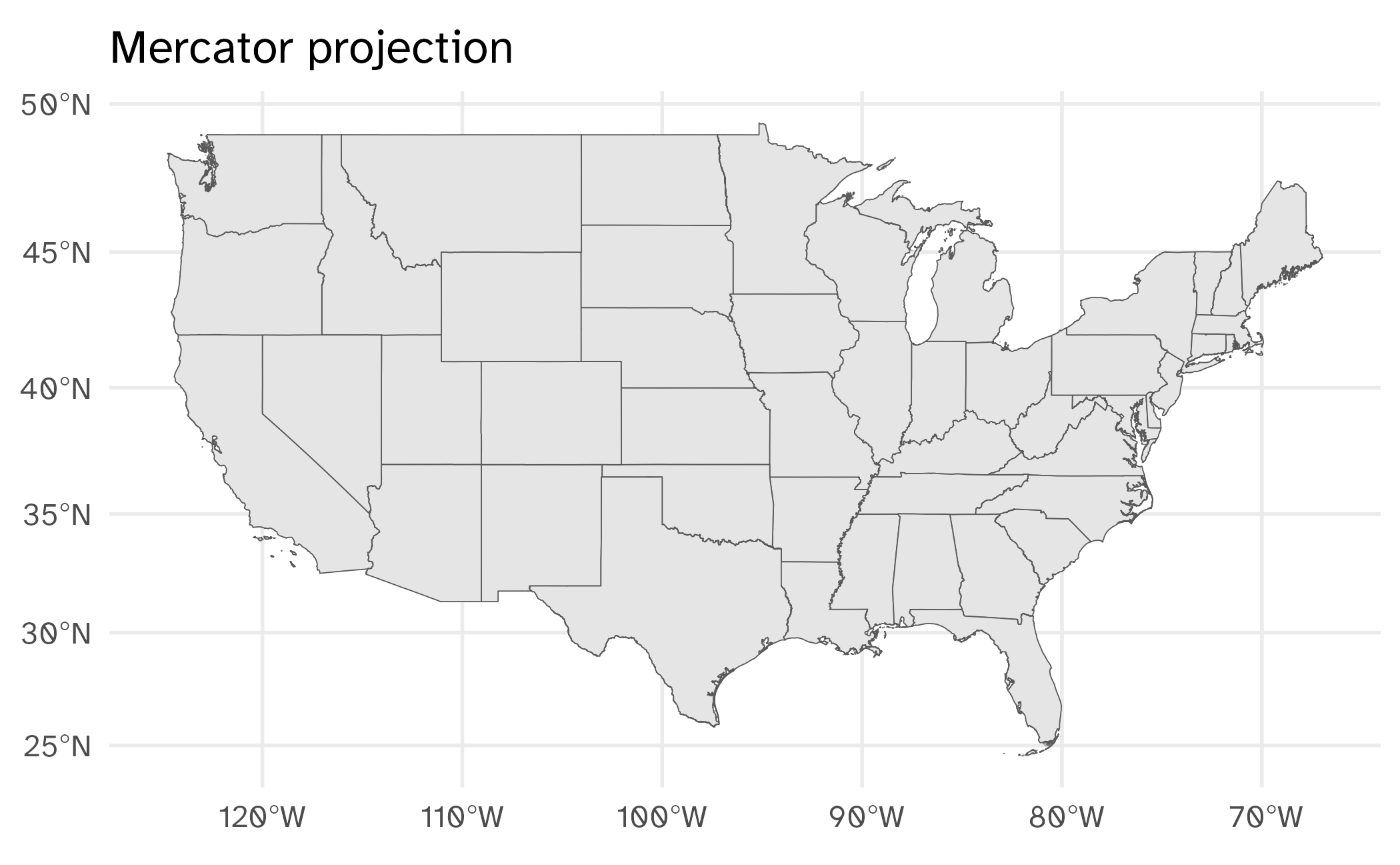
Mercator projection
Alternative projections
South on the top

Source: StackOverflow
Selecting an appropriate projection method
# A tibble: 10 × 6
   crs_code crs_name                                      crs_type  crs_gcs crs_units crs_proj4
   <chr>    <chr>                                         <chr>       <dbl> <chr>     <chr>
 1 6539     NAD83(2011) / New York Long Island (ftUS)     projected    6318 us-ft     +proj=lcc +la…
 2 6538     NAD83(2011) / New York Long Island            projected    6318 m         +proj=lcc +la…
 3 4456     NAD27 / New York Long Island                  projected    4267 us-ft     +proj=lcc +la…
 4 3628     NAD83(NSRS2007) / New York Long Island (ftUS) projected    4759 us-ft     +proj=lcc +la…
 5 3627     NAD83(NSRS2007) / New York Long Island        projected    4759 m         +proj=lcc +la…
 6 32118    NAD83 / New York Long Island                  projected    4269 m         +proj=lcc +la…
 7 2908     NAD83(HARN) / New York Long Island (ftUS)     projected    4152 us-ft     +proj=lcc +la…
 8 2831     NAD83(HARN) / New York Long Island            projected    4152 m         +proj=lcc +la…
 9 2263     NAD83 / New York Long Island (ftUS)           projected    4269 us-ft     +proj=lcc +la…
10 3748     NAD83(HARN) / UTM zone 18N                    projected    4152 m         +proj=utm +zo…
Application exercise
ae-17
Work through part 2
- Modify the map to use a binned color scale
- Implement a projection method appropriate for the state of New York
Wrap-up
Recap
- Structure geographic features using vector data and simple features
- Use
geom_sf()to visualize simple features data in {ggplot2} - Consider spatially aggregating your observations for more effective communication
- Deliberately select color palettes and projection methods
How to make the bivariate color palette
# import health data
# source: https://chronicdata.cdc.gov/500-Cities-Places/PLACES-County-Data-GIS-Friendly-Format-2024-releas/i46a-9kgh/about_data
county_health <- read_csv(file = here("slides/data/PLACES__County_Data__GIS_Friendly_Format___2024_release_20250326.csv")) |>
  select(GEOID = CountyFIPS, drinking = BINGE_AdjPrev, smoking = CSMOKING_AdjPrev)

# get county/state boundaries
county_sf <- counties(cb = TRUE) |>
  # only keep counties in US states
  semi_join(
    y = fips_codes |>
      filter(state_name %in% state.name),
    by = join_by(
      STATEFP == state_code,
      COUNTYFP == county_code
    )
  ) |>
  # shift Alaska and Hawaii
  shift_geometry()

state_sf <- states(cb = TRUE) |>
  filter(NAME %in% state.name) |>
  # shift Alaska and Hawaii
  shift_geometry()
How to make the bivariate color palette
# create map
smoke_drink_map <- left_join(x = county_sf, y = county_health) |>
  # use biscales to create bivariate color palette
  bi_class(
    x = smoking,
    y = drinking,
    style = "quantile"
  ) |>
  # draw map
  ggplot() +
  geom_sf(mapping = aes(fill = bi_class), linewidth = 0.1) +
  # overlay state boundaries for context
  geom_sf(data = state_sf, fill = NA, color = "white") +
  # use biscale color palette
  bi_scale_fill(pal = "PinkGrn", guide = "none") +
  # appropriate labels and theme
  labs(
    title = "Smoking and excessive drinking in the United States",
    caption = "Source: Behavioral Risk Factor Surveillance System (2022)"
  ) +
  theme_map(base_family = "Atkinson Hyperlegible", base_size = 14)

# create legend
smoke_drink_legend <- bi_legend(
  pal = "PinkGrn",
  dim = 3,
  xlab = "Higher % Smokers",
  ylab = "Higher % Binge Drinkers",
  size = 9,
  pad_width = 1.5, pad_color = "white",
  rotate_pal = FALSE,
  base_family = "Atkinson Hyperlegible"
) +
  # fix justification of text labels
  theme(
    axis.title.x = element_text(hjust = 0),
    axis.title.y = element_text(hjust = 0)
  )

# combine map + legend with patchwork
smoke_drink_map +
  inset_element(smoke_drink_legend,
    left = 0, bottom = 0.3, right = 0.20, top = 0.575
  )